Cotabato City
Cotabato City, officially the City of Cotabato (Malay: Kota Batu; Maguindanaon: Kuta Wato; Cebuano: Dakbayan sa Cotabato;Hiligaynon: Dakbanwa/Syudad sang Cotabato; Filipino: Lungsod ng Cotabato; Spanish: Ciudad de Cotabato), is one of the independent component cities located in Mindanao, Philippines. According to the 2015 census, it has a population of 299,438.
Cotabato City is the regional center of the Autonomous Region in Muslinn Maguindanao (ARMM) but the city is administratively part of the Soccskargen region, which is composed of the provinces of South Cotabato, (North) Cotabato, Sultan Kudarat, andSaranggani, as well as the highly urbanized city of General Santos. For geographical, statistical and legislative purposes, it is grouped with the province of Maguindanao but still does not belong to the ARMM.
Cotabato City is distinct from and should not be confused with the province of Cotabato.The Grand Mosque
How to get there? Take a south-bound Awang jeep and ask the driver to drop you off at the Husky Bus Terminal. From there, hire motorbike (habal-habal) to take you to the Grand Mosque. The round trip fare is 100-150 Php.
Tamontaka Church
 This is the oldest Christian church in Cotabato City. It was built in 1872 by Spanish friars as can be easily seen in its architecture and design. Inside, you will find relics of the living past, which together with the church housing them stand in testimony that both the Muslim and Christian religion can co-exist harmoniously. One of the most interesting features of the Tamontaka Church is its underground passageway leading to a catacomb which is part of a network of caves for which Cotabato is named from.
 Kutang Bato Cave
Found right at the heart of the city, is the one-of-its-kind Kutang Bato Cave. It was used by Filipino soldiers during the Second World War to outsmart and fight the Japanese invaders. It had also provided natives a sanctuary when the Spaniards tried to convert them to Christians. The cave has several entrances scattered around the city, but only four are open to admit visitors.
 This monument was built in honor of Japan’s Provincial Commander Takumi Butai and Japanese soldiers who died in the city during Second World War. It was the Butai’s wish to have his ashes be buried in the city when he died. The shrine was put up Kyoto’s Lion’s Club in cooperation with Cotabato’s City Government.
PC Hill
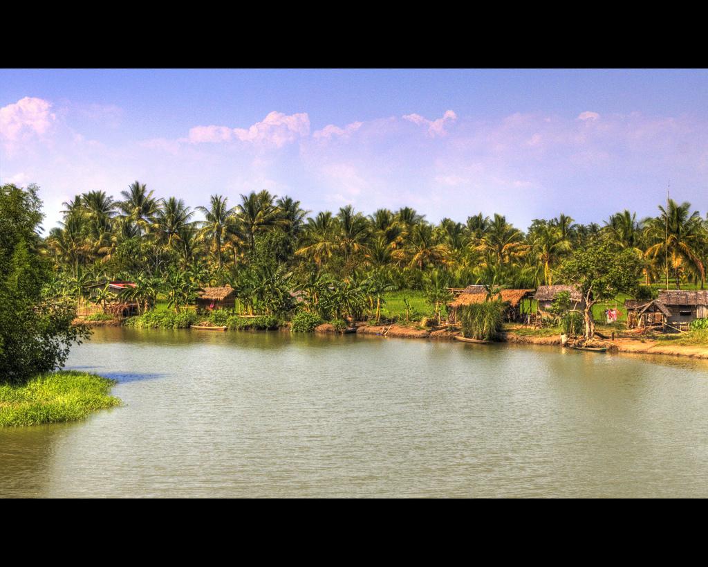
Rio Grande de Mindanao
This is the longest river in Mindanao and second largest river in the Philippine. It is estimated to be 96 meters wide and 182 kilometers long. Various watersports and boat racing activities are held along it, especially during the Feast of Peñafrancia and the Shariff Kabunsuan Festival.Cotabato City is one interesting destination and the above tourist spots are but a few must-see. There are certainly a whole lot more places of interest that will make you want to give the city a second visit.
Takumi Butai Memorial Shrine

PC Hill
PC Hill is a 90-feet stone fort used by the natives as a watch tower to detect and repel enemy assaults during the war. It gives a panoramic view of the whole city as well as the Rio Grande de Mindanao. Today, it serves as a headquarters to the Cotabato City Internal Defense Command.
